
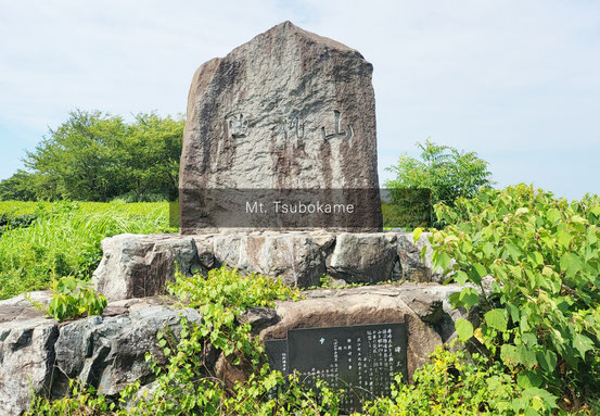
15. 壺瓶山(つぼかめやま)
【SCENIC SPOT WHERE YOU CAN SEE BOTH OCEAN AND MT. DAISEN. ALSO, THE MOUNTAIN IS FILLED WITH RUINS AND WHERE IT ONCE BECAME THE FORTRESS FOR THE UPRISING】 【日本海や大山を見渡せる展望スポット、古墳群・一揆の砦となった山】
Quiz
What kind of crop has been mainly raised at Mt. Tsubokame?
壺瓶山には何の畑が広がっているでしょうか?
I. Tea(茶畑)
J. Tobacco(たばこ畑)
About
Flat mountain with an elevation of 113.7 meters. Yodoe Tunnel of the San’in Expressway penetrates this mountain.
標高113.7mの平らな山で、山陰道の淀江トンネルがこの山を貫いています。
Tsubokameyama Burial Mounds are a group of over forty mounds spread all over the mountain.
壺瓶山(つぼかめやま)古墳群は、壺瓶山に築かれた40基以上の古墳の総称です。
The name “Mt. Tsubokame” refers to the fact that many vases and bottles were found here (tsubo means ‘vase’ and kame means ‘bottle’).
「壺瓶山」の名は、山から多くの壺や瓶が発見されたことに由来すると言われています。
The routes in this mountain used to be the major road. Also, there was a facility to make smoke signals (called Tobuhi) in the case of an emergency.
伯耆志には「坪上山」とも記されていて、かつては官道(駅路)が通り、また烽(とぶひ)<緊急時にのろしを上げて急を知らせる施設> の山であったとする説もあります。
In addition, there is a reference in the book Shimafu Genhiroku that a large number of peasants gathered and barricaded themselves in this mountain for the uprising in December 1750.
また、江戸時代、『島府厳秘録」に、寛延3(1750)年12月に伯耆の壺瓶山に百姓が大勢立てこもり、近隣の農民一揆の結集地となったことが記載されています。
Address
Yodoecho Nishibara
Yonago, Tottori 689-3403
(住所)
〒689-3403 鳥取県米子市淀江町西原
QUIZ COMMENTARY (クイズ解説)
【Correct Answer】I. Tea(茶畑)
Vast tea fields spread from the middle to the top of Mt. Tsubokame.
壺瓶山の中腹から頂上付近にかけて、広大な茶畑が広がります。
These fields belong to the Fukui Seicha tea company, whose processing factory is located at the bottom of the mountain.
壺瓶山麓の福井地域にある「福井製茶」が栽培する茶畑です。福井製茶では、この茶畑で茶摘みをして、自社工場にてお茶を製造しています。
In Yodoe Town, tobacco leaf cultivation became popular after the type of crop called “Bichu-Yo” was introduced in 1948.
淀江町では、昭和23年頃から葉たばこの「備中葉」を導入してから、砂地での葉たばこの耕作も盛んでした。
コメントをお書きください